MENU

- Home
- Video Books
- Grade 11
- Grade 12
- Grade 9
- Grade 10
- Java
- Photoshop
- Computer Troubleshooting
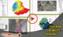
- GIS
- Computer tutorials for Advanced users
- Graphic Design Tutorial
- Grade 7
- Grade 8
- GRADE 9
- GRADE 10
- Basic English
- Basic IT
- Engineering
- GRADE 1
- Grade 1
- Grade 2
- Grade 3
- Grade 4
- Championship
- Grade 11
- Grade 12
- Grade 9
- Grade 10
- Java
- Photoshop
- Computer Troubleshooting
- GIS
- Computer tutorials for Advanced users
- Graphic Design Tutorial
- Grade 7
- Grade 8
- GRADE 9
- GRADE 10
- Basic English
- Basic IT
- Engineering
- GRADE 1
- Grade 1
- Grade 2
- Grade 3
- Grade 4
- Services
- Downloads
- Channels
- E-Library
- Contact Us
- About Us